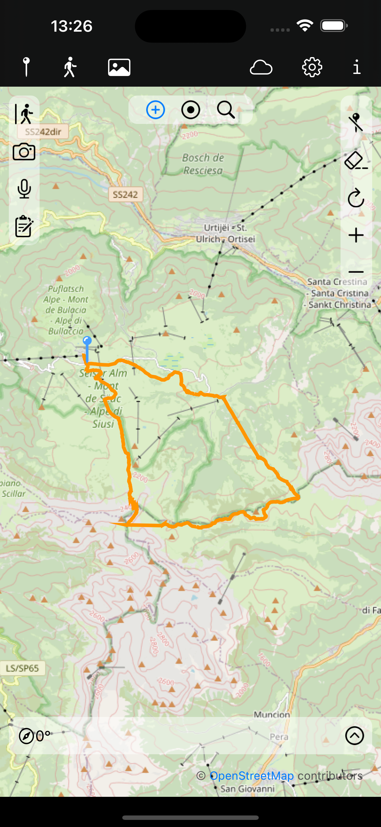
Maps For OSM (Mobile App)
Maps For OSM is an app for OpenStreetMap-Maps for IOS, i.e. iPhones and iPads.
With it you can mark and describe places, add photos, record tracks and export them as GPX files.
There is no tracking, no ads and no data leave the device if not expicitly exported (Privacy)
 Map View
Icons of the main menu from left:
- List of all locations
- List of all tracks
- List of all images
- iCloud
- Settings
- This information
Left map menu from top:
- Start, save, cancel recording a track
- Open camera
- Record audio
- Write a note
Top map menu from left:
- Show or hide a map cross (centered on the map)
- Center map to current location
- Open search
Right map menu from top:
- Show or hide location markers
- Hide currently visible track
- Reload map
- Zoom in
- Zoom out
Bottom information:
This shows GPS info:
- Direction (Compass)
- Extended view (right chevron) shows mor GPS data
While recording a track detailed track info and a button to pause and resume is shown.

